
Correcting TRMM Data
Bias Correction of Long-term Satellite Monthly Precipitation Product Over the Conterminous United States
The Problem
Despite the unique areal coverage and advanced algorithm of the Tropical Rainfall Measuring Mission (TRMM) Multi-satellite Precipitation Analysis (TMPA), numerous studies have shown that TRMM-TMPA precipitation product displays differences when compared to ground-based observations. In this project, we find that the inaccuracy in the satellite product has a high dependence on some environmental factors that cause bias in the satellite data relative to the ground-based observation.
Our Approach
In this study, we investigate the differences between satellite-based and ground-based precipitation estimates as a function of various environmental factors. By using this relationship, we are able to remove the identified factors’ effect on the satellite product, thereby improving the accuracy of the satellite product.
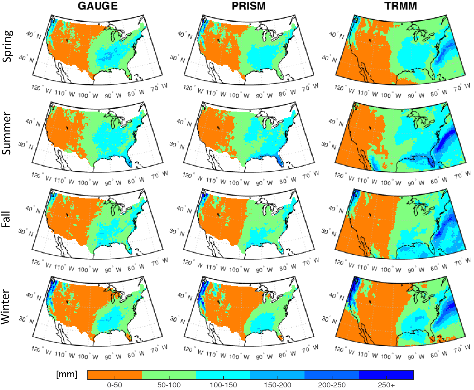
Averaged seasonal precipitation map in mm (from 1998 through 2015) over the conterminous United States from three different data sources: 1) gridded precipitation based on the rain gauge measurements (GAUGE), 2) parameter-elevation regressions on independent slopes model product (PRISM), and 3) the TRMM-3B43 satellite product (TRMM).
Results to Date
The bias between the satellite precipitation product (TRMM 3B43) and ground-based estimates were compared with surface elevation. The analysis of bias with respect to elevation indicated a strong bias-elevation relationship associated with two distinct elevation ranges, below and above 1500 m amsl, with significant negative bias at the high elevations. We developed a model to correct the TRMM 3B43 product under the assumption that the bias is related to retrievals from the TRMM multisatellite, as well as from merging the ground-based estimate with TRMM multisatellite estimates, and in particular, is dependent on elevation. The results showed major improvement in the satellite product (1998-2015) by reducing bias up to 95% in the high mountainous areas of the conterminous United States (CONUS).